by Andy Styer
Tod Slabik first approached me with this 4 or 5 weeks ago as he was trying to get a group of like-minded runners together to do this challenge.
First off, the 4 state challenge is PA, MD, WV and VA. You really don’t spend more than a minute in PA or VA as you are basically starting right near the Mason Dixon line in Pen Mar, PA and ending basically once you hit the VA line. WV only has maybe 2-3 miles of the AT coming through, so you are mostly in MD. You do this in self-supported fashion, which means you are carrying all of your own food.
I left my house around 2 a.m. on Saturday after grabbing 6 solid hours of sleep. I met Tod along the way around 2:30 a.m. From there we drove approximately 3 hours to Harpers Ferry, WV, where we dropped his car, and then drove up 1 hour to Pen Mar to park. We were a bit surprised to see the small lot full, so we had to fumble around a bit to find alternate parking slightly on the MD side of things.
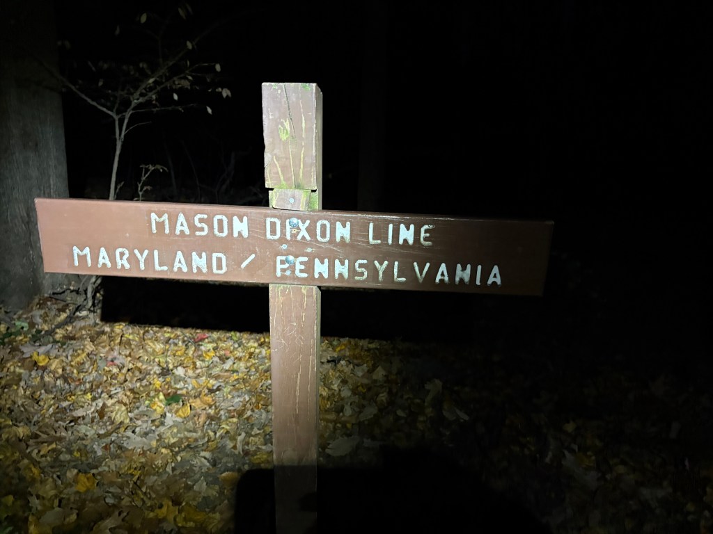
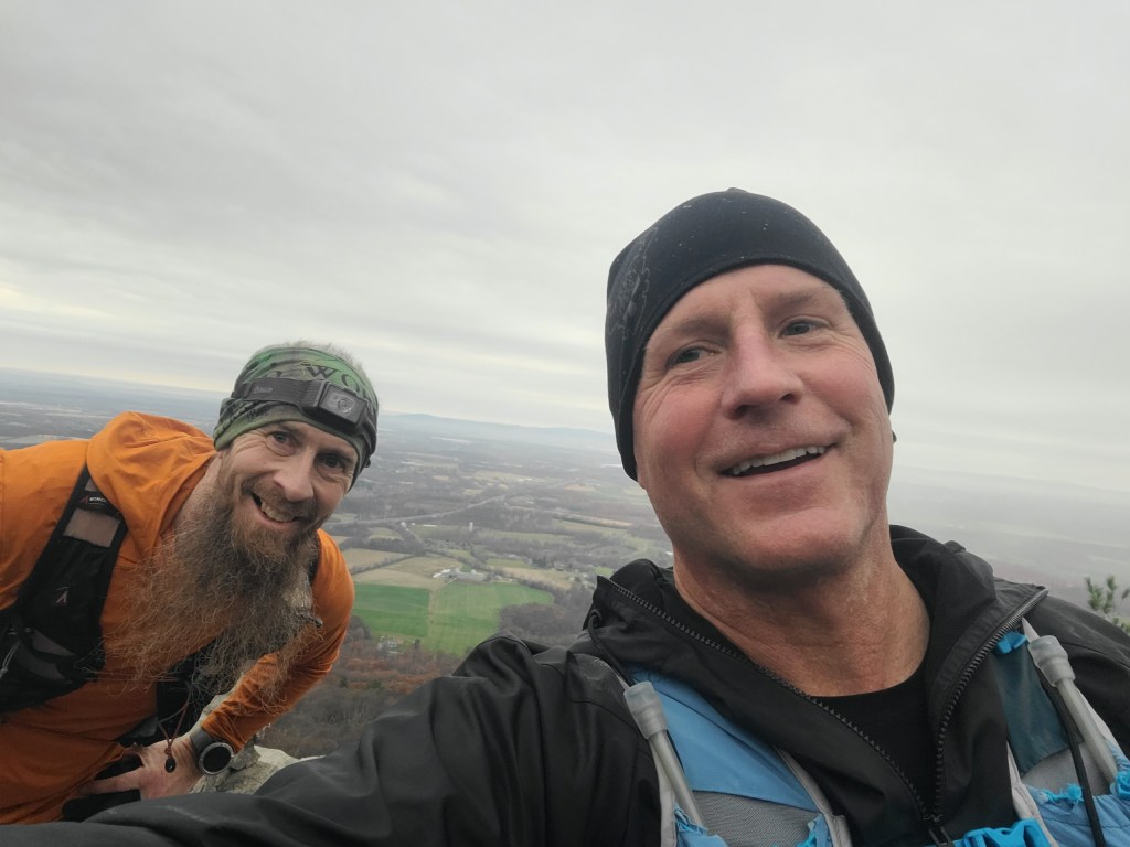
Shortly after 6 a.m. and with headlamps on, we trekked down to the start, so we could officially start on the PA side of the trail. We mostly hiked and ran where we could, as the terrain is somewhat tricky on the first part. We came across several vistas with great views of the valley below. We also passed quite a few hikers early on and throughout the first 15 miles or so.
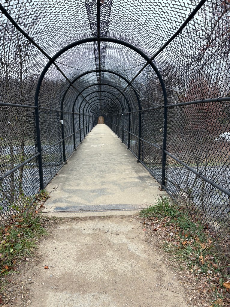
The trail really was very runnable in many spots, and as we got closer to mile 18, the foot traffic increased a bit. At the bottom of the one hill, we saw a large parking area right near Interstate 70. They have a special foot bridge going over I-70, and shortly after this we discovered a gallon of much-needed water on the trail (AKA “trail magic”). We filled up and continued to Washington Monument Park at around mile 21.5 of our journey. Here we snapped a few pics and filled our water again at their well pump. It’s an official park, but we assume still closed due to the lingering effects of the shutdown.
We carried on and encountered sporadic groups of hikers along the way. We eventually made it to the part of the AT featured in the iconic JFK 50-mile ultra. I had done this in 2021, but didn’t really remember too much. At around mile 31, we came across another Battlefield park, which thankfully had a well pump which we could use to refill our water. As we went on, the foot traffic became really heavy with Boy Scouts on a camping adventure. At around mile 37 we started the hard switchback descent down the hill, made more complex with hikers moving at a slower speed going the same way. Some were very courteous and moved to the side, but others were a bit oblivious, and we had to announce ourselves a couple of times.
At the bottom, the AT follows the C&O path along the Potomac for a few miles. When you have been running really nice mountain trails for 38+ miles, it’s soul-crushing to have to run something flat and boring for 3 miles. But we did what we had to in order to carry on our mission. We then had to take a train bridge with a walking “side car” over the Potomac to get to Harpers Ferry. The trail then goes through town a bit, which is a little confusing until you find it, but then it goes up a million stone steps to get you out of town. By now, we were almost out of water and thought we were going right by Tod’s car, but it was actually another area where we parked that wasn’t even close. So, we grudgingly continued on since we were only about 3 miles to the VA border.
The final ascent was leaving the town, and running over a windy bridge over the Shenandoah River and then back on trail. It was almost 2 miles uphill, in the dark, out of water and dead tired. We had some navigational issues at this point in trying to find the exact location of the VA state line. We fumbled around a bit. I checked my map on my phone like 18 times, and at one point we both agreed we had crossed the line. If there was an actual sign, it’s no longer there. I called home to Kim to let her know I was grumpy and tired, but alive and OK. We then slowly (thanks to me being the slow one) made our way back down the hill to go back to the car. The quickest way back to the Harpers Ferry Visitor Center was a fast-moving state highway with enough shoulder to walk on–not exactly pleasant, but it was the quickest way.
Upon arriving back at Tod’s car, we changed out of our dirty clothes and shared a much-needed Pepsi after 13 hours of adventuring, that gave us over 48 miles with over 7000′ of total vertical gain. Minus the bumpy ending, this was a very satisfying day, and actually I would 100% do this again, especially knowing more about the logistics. The weather was really good all day. Not too warm, not too cold, and it stayed overcast with a few short showers.
After a short nap on the way home, I arrived back safely at 1 a.m.!
